

3 Ways to Measure Distance Between Two Points
Edited by Caroline Ryan | Feb 08, 2025 | Virtual Location
The accessibility of navigation apps has made traveling much more convenient when compared to the previous decade. Today, relying on applications such as Google Maps and Apple Maps has become a staple for regular travelers and road trip enthusiasts. However, navigation and distance are two separate subjects, especially when elements such as traffic jams are considered. In this article, we will provide a guide on how to measure the distance between two points or locations to provide objective information to our readers since an accurate distance will always be a good piece of information to have in mind. We will provide three different options that can be used to measure distance between two places. To learn essential details about this topic, please continue reading the article down below.
Navigation of Content:
Part 1. How to Measure Distance Between Two Points with Exact Addresses
Measuring the distance between two exact addresses is easier when compared to measuring the distance between unidentified locations on a map. Because of that, measuring the distance between two specific addresses will be the first solution that we will feature today.
In this guide, we will use Google Maps as the main distance measuring program that we will use. This software has been selected since it is the most popular navigation and digital application that most motorist uses today. Moreover, the two measuring options that we will present will cover an option to provide an exact distance measurement. In contrast, the other option will tackle the more practical distance measurement of estimated traveling time.
Without further ado, let us now proceed to the distance measurement guides:
Using Google Maps’ Measure Distance Function
Measure distance is the most straightforward feature in Google Maps. It does exactly what it is called and it can be used by only following three simple steps.
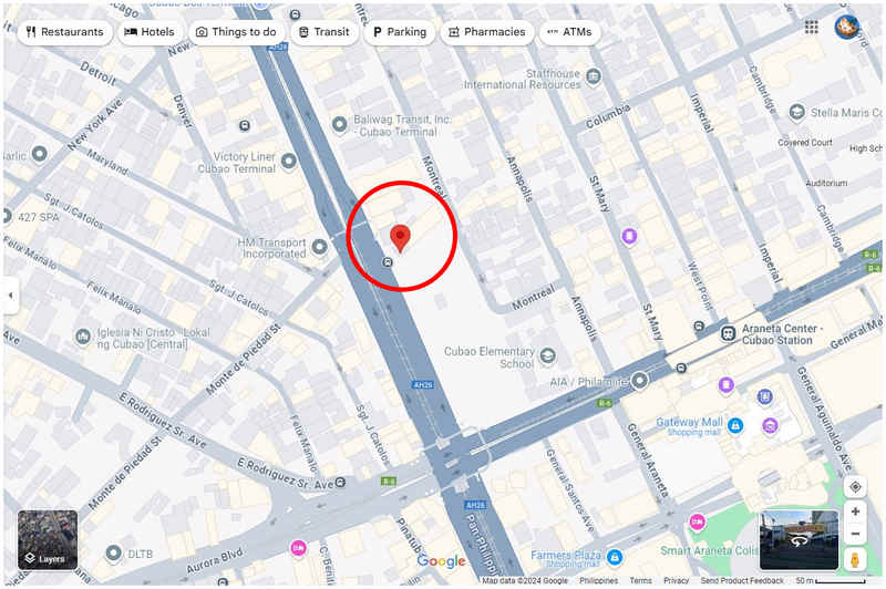
Step 1. Open Google Maps web client and click on a location in the map to set it as the first point.
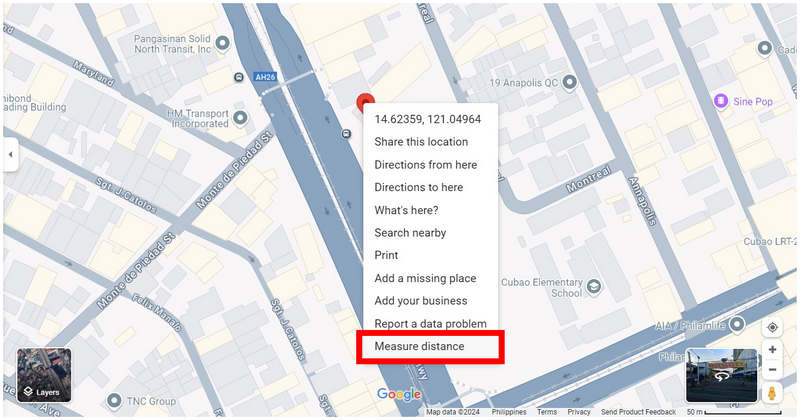
Step 2. Right-click on the location that you selected and click on Measure Distance.
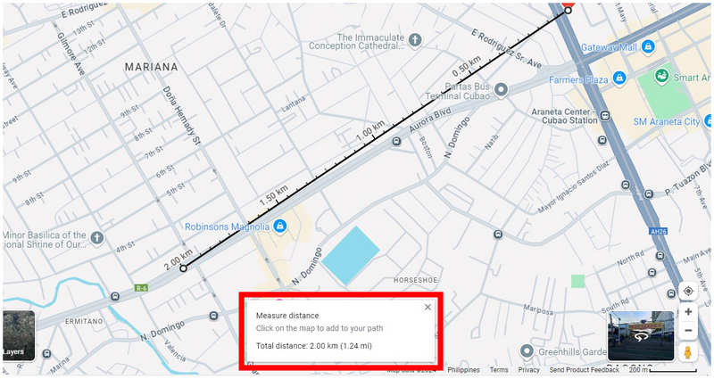
Step 3. Navigate the digital map to find the place that you want to use as a second point, and click on it. Afterward, a small window on Google Maps will appear where the total distance between the two points that you selected is indicated.
Google Maps’ measure distance function is highly practical for its users. Unfortunately, this option is not available for all mobile devices which made us create this guide using Google Maps web client. Another factor to consider with location distance is if you are using dating apps and you want to change location in Tinder, Bumble, Grind, or other similar apps.
Using Estimated Traveling Time
Although distance is the most objective measurement to learn the interval between two points, a more realistic measurement to use is none other than estimated traveling time. By using this as the main factor, external elements such as traffic and road conditions will be considered as important variables.
To learn how to know the estimated traveling between two points in Google Maps, please follow the five-step guide below. This time, the guide was built using the Google Maps app since this measurement is readily available on their app for the smartphone platform.
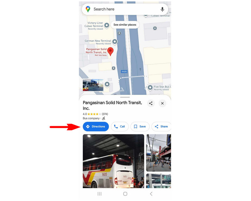
Step 1. Tap the exact address that you want to use as the first point. Then, select Directions.
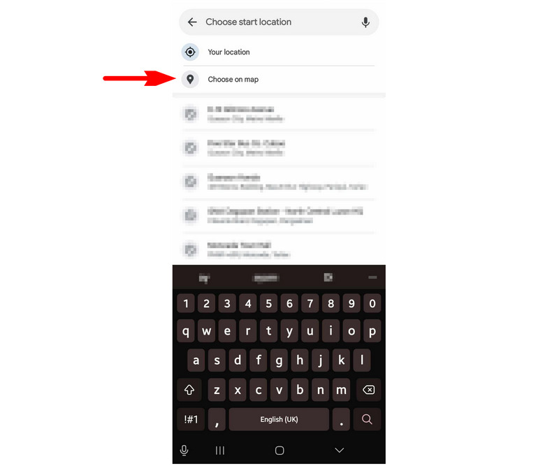
Step 2. In the next window, tap on Choose start location.
Step 3. For a more accurate setting of the second point, select the Choose on map option.
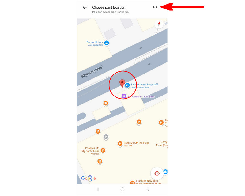
Step 4. Navigate the digital map by dragging it until the area that you want to use as the second point is under the Red Pin. Tap on OK to confirm your selection.
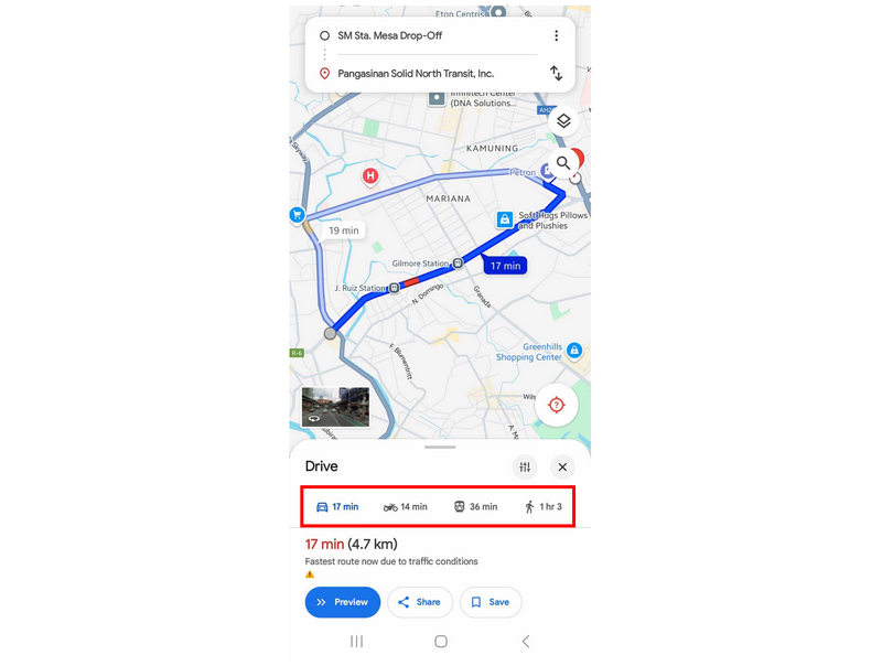
Step 5. Google Maps will now provide you with an estimated traveling time between the two points that you have selected using four transportation options. These transportation options are private four-wheeled vehicle, motorcycle, public transportation, and walking.
If practicality and realism are some of the considerations that you value, we highly recommend using estimated traveling time as your primary measurement when learning the distance between two points.
Part 2. How to Measure Distance Between Two Points Without Exact Addresses
Now that we have featured the guide to learn the distance between locations with specific addresses let us now proceed to the option to know the distance between destinations with no official address since this barrier is trickier to solve. With that in mind, using a virtual location tool is highly recommended since it will be the easiest option to use the distance between specific points on a map. In this case, AnyCoord Location Changer should be your first option when looking for an effective virtual location software.
Designed to alter location and GPS data, AnyCoord Location Changer is equipped with advanced GPS measurement features to determine specific traveling variables such as distance, estimated time, and speed. Due to that, it can determine both the exact distance and estimated traveling time between two separate points and locations in its digital map.
AnyCoord Location Changer Main Features:
• One-stop mode is a point-to-point location changer and tool to measure accurate distance between two addresses.
• Adjustable traveling simulation speed to maintain a realistic pace.
• Joystick mode, which is designed for manually controlling your virtual location.
• Multi-stop mode to set multiple locations as different stops.
• Designed to hide your real location for increased security and privacy when using location-based applications.
If you are interested in trying this software due to its practical features, make sure to download it now to easily follow our provided guide on how to use it below:
100% Secure & Clean
100% Secure & Clean
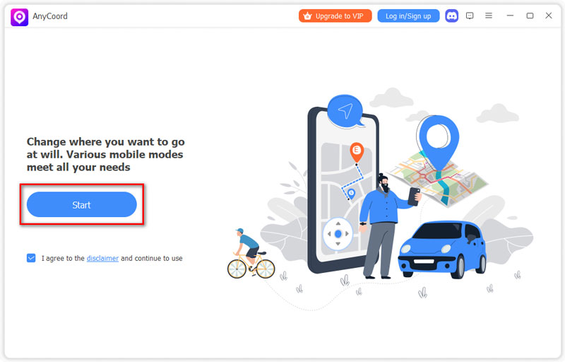
Step 1. Connect your smartphone to your computer using a USB cable. Once the connection is established, click Start in AnyCoord Location Changer.
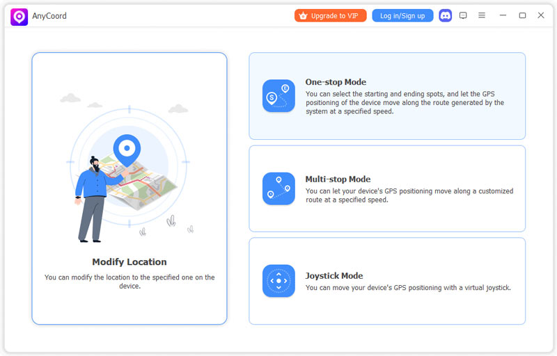
Step 2. Click on the One Stop Mode in the software’s mode selection menu. This mode should be your best option if you want to determine the distance between two places with unknown addresses.
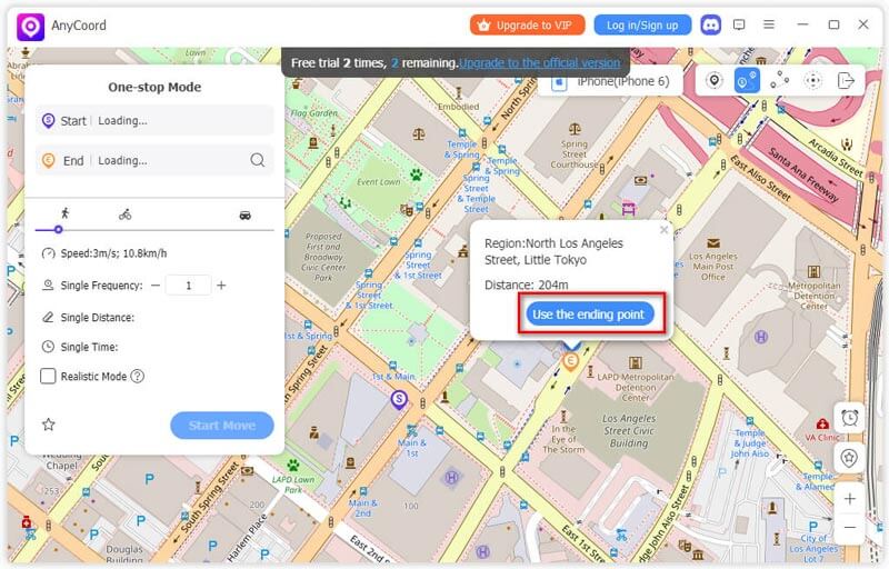
Step 3. Once you have gained access to the digital map of AnyCoord Location Changer, click on the two unknown addresses that you want to learn the distance in between. The first point that you will select will be set as the Starting Point, while the second one will be the Ending Point.
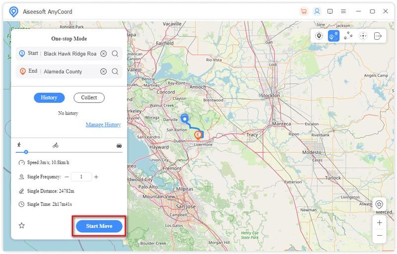
Step 4. Now that the two points that you selected have been set, AnyCoord Location Changer will give the exact distance between the two points in the software’s navigation menu. The exact distance can be seen in the Single Distance indicator, while the estimated time can be found in Single Time. If you want to use the software to adjust your virtual location, simply click on Start Move to begin the traveling simulation.
By following these four simple steps, the objective distance and estimated traveling time between two points can now be determined by using one dedicated software designed for location services. This highly practical information can all be collected by using AnyCoord Location Changer.
Part 3. FAQs About Distance Between Two Points
-
1Can Google Maps show the distance between two points?
Yes, it can. Google Maps has a measure distance feature that you can use. However, this feature is not available to all mobile versions of Maps.
-
2What is the distance between two points on a map?
The distance between two points in a map determines the interval between them. Fortunately, navigation apps are highly accessible today, making distance measurement easy to do. Read our provided guide in this article to learn how to know the distance between two points.
-
3How do I find the distance between two points in Google Earth?
Open the Google Earth app. Then, select a location on it. Tap on the Measure option and adjust the pin to set it as the second point. The distance between each point will now show.
-
4Is estimated traveling time a good measurement for distance?
Yes, it is. Although traveling time is not a unit of distance itself, it is the most practical and realistic option to estimate distance. Traveling time counts for all variables, such as traffic and road conditions, making it highly realistic. These factors are important if you are into location-based gaming.
-
5Is Google Maps a good navigation software?
Yes, it is. In fact, Google Maps is the most trusted and used navigation app today. A close second is Apple Maps, which is still rising in popularity.
Conclusion
Now that we have provided you with a detailed guide on different ways to measure distance between points and locations, we hope that this article has proved useful for your regular navigation needs.
Please share this article online to help other users who are having similar questions or problems.


AnyCoord is the best tool to change, hide, or spoof your location in games, social media apps, and other apps on iPhone or Android devices.
100% Secure & Clean
100% Secure & Clean